Jackson County · Josephine County · Southern OregonSouthern Oregon, together
Rogue Valley Now
Menu
Before you head out

Check conditions around the valley

Start here to find the right live map, understand what it shows and know where to look when conditions change.
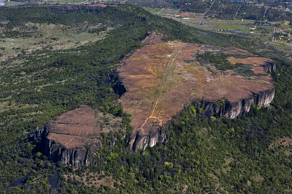
Table Rocks and the Rogue ValleyTABLE ROCKS · ROGUE VALLEY
For an immediate threat, follow official notices.Maps and feeds can lag. Check your county’s evacuation information and sign up for alerts before you need them. Find county alert systems →
Travel

Roads and closures

TripCheck is Oregon’s road map for incidents, closures, construction, weather and cameras. Check the whole route, especially I-5 and the mountain or river roads you plan to use.

For local bus travel, check RVTD routes and schedules ↗. The official map is the final word on a closure.

Grants Pass road-work notices

Last checked Sep 26, 3:18 PM PDT.

No recent notices were returned by this city feed. This does not mean every road is open.

USGS river gauges

Rogue, Applegate and Illinois rivers

Rogue River at Grants Pass

1,100 cubic feet per second

Gauge height: 0.98 feet.

Josephine County · USGS station USGS-14361500. Observed Sep 26, 2026, 3:10 PM Pacific time. Provisional readings may be revised.

USGS gauge details ↗

Applegate River near Applegate

111 cubic feet per second

Gauge height: 1.01 feet.

Jackson County · USGS station USGS-14366000. Observed Sep 26, 2026, 3:10 PM Pacific time. Provisional readings may be revised.

USGS gauge details ↗

Illinois River near Kerby

33 cubic feet per second

Gauge height: 0.68 feet.

Josephine County · USGS station USGS-14377100. Observed Sep 26, 2026, 2:45 PM Pacific time. Provisional readings may be revised.

USGS gauge details ↗

Last checked Sep 26, 3:18 PM PDT. Source updated Sep 26, 3:10 PM PDT.

RVTD vehicle feed

Where are the buses?

Last checked Sep 26, 3:18 PM PDT. Source updated Sep 26, 3:17 PM PDT.

RVTD is not reporting active vehicle locations in this snapshot. Check the schedule for service hours.

Vehicle locations are reported by RVTD. Arrival predictions are not included here yet.

RVTD routes and schedules ↗
Smoke and health

Air quality

Oregon DEQ’s live AQI map shows readings at monitoring stations. Select the station nearest your destination; air quality may be different across the valley, especially during smoke events.

0–50 Good51–100 Moderate101–150 Sensitive groups151+ Unhealthy or worse

The colors above explain AQI ranges; they are not a reading for your location.

Fire season

Wildfire and evacuation information

Use the Oregon fire situation map for larger tracked fires. For evacuation instructions, check your county’s emergency management page and alerts; a state fire map alone does not tell you whether your address is under an order.

Oregon’s Ready, Set, Go evacuation guide ↗ explains the three levels.

NIFC current incident records · Jackson and Josephine counties

Last checked Sep 26, 3:18 PM PDT. Source updated Sep 26, 8:08 AM PDT.

Hinkle Gulch · Jackson CountyUpdated Sep 26, 2026, 8:08 AM Pacific time · Reported size 0.33 acres
Lakeshore Dr. 990 · Josephine CountyUpdated Sep 24, 2026, 4:58 PM Pacific time
Hammel Rd 1501 · Jackson CountyUpdated Sep 24, 2026, 8:45 AM Pacific time · Reported size 0.01 acres
Anderson Butte Rd MM4 · Jackson CountyUpdated Sep 23, 2026, 6:44 PM Pacific time
Crow Rd 2275 · Josephine CountyUpdated Sep 23, 2026, 4:02 PM Pacific time

Mapped fire perimeters

Last checked Sep 26, 3:18 PM PDT. Source updated Sep 21, 9:54 AM PDT.

Anderson Butte Rd MM4 · Jackson CountyPerimeter mapped Sep 21, 2026, 9:54 AM Pacific time · Mapped area 76 acres

NIFC describes these as working geospatial records that can change. A mapped perimeter is not an evacuation boundary.

NIFC WFIGS data and limitations ↗