Upper or Lower Table Rock?
Two climbs, one remarkable landscape. Use the land manager’s trail facts to pick a route that fits your time and group, then check current access before leaving.
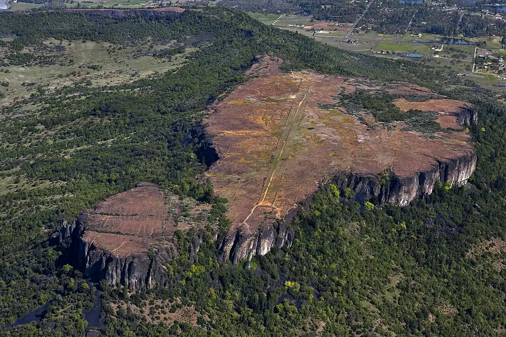 TABLE ROCKS · ROGUE VALLEY
Pick by effort and purpose
Upper is the shorter climb to the top, but BLM says it generally draws more people and can be muddier in wet conditions. Lower takes longer, has interpretive signs and tends to draw fewer hikers. For a short, gentler walk, use the Oak Savannah Trail at the Lower Table Rock trailhead instead of either summit route.
Compare the three routes
| Route | Round trip | Elevation gain | BLM estimate | Best reason to choose it |
|---|---|---|---|---|
| Upper Table Rock summit | 2.5 miles | 736 feet | 2–3 hours | Shorter summit route; expect more people and potentially muddy ground. |
| Lower Table Rock summit | 2.8 miles | 809 feet | 3–4 hours | Interpretive signs and typically fewer hikers. |
| Lower Oak Savannah Trail | 0.5 mile | 80 feet | About 30 minutes | An easier interpretive walk without the summit climb. |
Source: BLM Plan Your Visit. The BLM identifies the Oak Savannah Trail as the accessible trail in this area. Confirm current conditions and accessibility details with the land manager before your visit.
Choose Upper for the shorter summit climb
The BLM lists a 2.5-mile round trip to the top, with 736 feet of gain and some steep sections. The first mile has gravel surfacing; the final quarter mile is natural surface. There is an optional 0.75-mile loop around the rim after reaching the top.
It is generally busier than Lower. The BLM warns that wet weather makes trails muddy and slick, particularly on Upper. Choose another day if heat, smoke or footing makes the climb unsuitable for your group.
Upper trail details and directions ↗Choose Lower for interpretation and more time outdoors
The summit route is 2.8 miles round trip with 809 feet of gain, moderate difficulty and some steep sections. BLM estimates 3–4 hours and notes interpretive signs along the trail. An additional 1.5-mile round trip on the top leads toward a south viewpoint.
If the summit is too much, the separate Oak Savannah Trail starts at the Lower area and offers a 0.5-mile round trip with interpretive signs. Do not mistake it for a shortcut to the plateau.
Lower trail details and directions ↗Rules and conditions worth checking
- No dogs: The BLM prohibits dogs at the Table Rocks to protect wildlife.
- Hiking only: Horses, bikes and off-highway vehicles are not allowed on the trails.
- Bring water: There is no drinking water at the trailheads or on top. Vault toilets are at the parking areas, not the summits.
- Protect the habitat: Stay on existing trails, avoid the vernal pools, leave flowers in place and use the weed stations.
- Watch the edge: The high cliffs and loose rock are hazardous, especially when wet.
Check the Rogue Valley conditions page for air and roads, then verify trail access and rules with the BLM. Conditions can change after this guide is published.
Understand the place you are visiting
The Table Rocks are part of the Takelma homeland. The BLM’s cultural history and Takelma Today material give context that a trail statistic cannot. The plateaus also hold sensitive vernal pool habitat, which is why staying on the trail matters even when the summit looks open and walkable.
Start with the BLM cultural history ↗ and our regional history overview →. For an outing elsewhere, return to the activity guides → or the Central Point town guide →.
Photo: Bureau of Land Management (CC BY 2.0), cropped. Trail facts checked against the BLM guide on September 26, 2026.