Language / Idioma
Jackson County · Josephine County · Southern OregonSouthern Oregon, together
Rogue Valley Now
Menu
The outdoors · Jackson & Josephine counties

The Rogue Valley hiking guide

A region-wide starting point for creekside walks, foothill loops and high-country adventures. Find the right trail, then follow the people who manage it for the current map and access.

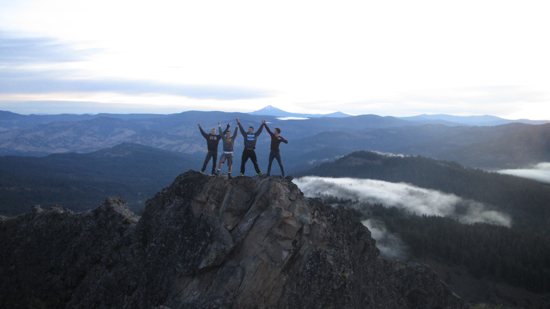
Hikers on Pilot Rock overlooking forested Cascade–Siskiyou mountainsPILOT ROCK · CASCADE–SISKIYOU
Start here

One valley, many ways outside

Start on a paved greenway in the valley, climb the Table Rocks, connect forest trails above Ashland, follow the Applegate's old ditch, or head toward the Oregon Caves and the upper Rogue. This directory covers 54 named routes and trail networks across seven areas.

There are more individual paths than any single static page can reliably enumerate. Open each trail’s dedicated page for route details, photographs where a verified image is available, additional descriptions and official video when found. The official inventories and maps below are the next stop for every connector, trailhead and new or changed route.

Explore by place and pace

Find your next trail

Search a place or trail name, then narrow by region or effort. “Choose your route” means the trail network has multiple lengths; start with the official map.

54 of 54 trail entries

Valley floor

5 entries
Choose a sectionChoose your route

Bear Creek Greenway

Ashland · Talent · Phoenix · Medford · Central Point

20-mile paved corridor; choose a section

A connected creekside route through five communities, useful for a short walk or a longer point-to-point outing.

Plan it: Plan a return route or pickup. Check county updates and share the path with cyclists.

Table Rocks & Jacksonville

7 entries

Ashland & Siskiyou foothills

11 entries
Named routeModerate

Grizzly Peak Trail

East of Ashland

3 miles one way to trail's end

Forest and open viewpoints over the valley in Cascade-Siskiyou National Monument.

Plan it: BLM lists 700 feet of climb. The best viewpoint is past the high point on the loop; snow can block the access road.

Named routeStrenuous

Pilot Rock approach

Green Springs

Follow BLM hike brochure

An iconic volcanic landmark accessed from the PCT corridor.

Plan it: The summit requires exposed scrambling; a hike to the rock's base is a different outing. Check seasonal wildlife restrictions.

Applegate Valley

9 entries

Grants Pass & Rogue River

4 entries
Trail networkChoose your route

Cathedral Hills

Grants Pass

Choose a loop on BLM map

Oak, madrone and conifer foothills with numerous connected loops.

Plan it: Popular with multiple user groups; use the official map and look for junction signs.

Trail networkChoose your route

Mountain of the Rogue

Rogue River

7-mile trail system; check permitted segments

Hillside views near the town of Rogue River.

Plan it: Designed chiefly for mountain biking. Only portions are shared with hikers and some are directional; follow the BLM map and signs.

Illinois Valley & Oregon Caves

8 entries

Upper Rogue & High Cascades

10 entries
Named routeStrenuous

Mt. McLoughlin Trail

Fish Lake · Sky Lakes Wilderness

5-mile trail to summit; return adds distance

A major Cascade summit hike rising high above the Rogue Valley.

Plan it: The Forest Service warns hikers to stay on the designated route on descent. Check snow and weather; this is a demanding mountain day.

Before you leave

Make the trail fit the day

Distances here are deliberately labeled as loops, round trips, one-way segments or variable networks. A trail's total mileage is not a promise of a simple day hike.

Check access today

Fire closures, smoke, snow, washed-out bridges, road gates and seasonal park hours can change. Check local conditions, then the land manager's alert page and the precise trail listing. The Forest Service currently lists an emergency closure affecting part of the Rogue River National Recreation Trail.

Current Rogue River trail closure ↗

Choose the right conditions

Open foothills can be hot and exposed; higher routes can hold snow long after spring arrives below. Carry water, navigation and a return plan. Waterfalls and rivers are viewpoints, not safe crossing or swimming guarantees.

National Weather Service Medford ↗

Know the rules

Dogs are prohibited at the Table Rocks and restricted in Lithia Park. Some trails are shared with bikes or horses, while parts of Mountain of the Rogue are directional and only some allow hikers. Follow the sign at the trailhead over a general guide.

Table Rocks rules ↗

Respect the place

Stay on marked trails around vernal pools and rare plants. The Table Rocks are part of Takelma homeland, and BLM's cultural history explains their significance. Pack out waste and use designated parking.

BLM cultural history ↗
Keep exploring

Where to find every trail

These are the source inventories behind the directory. Open the exact trail map for junctions, surface, rules and the latest conditions; this guide is an index, not a navigation map.

Keep planning

Explore the place around the trail

Find nearby towns and a current event for after your hike. For the summit routes, use our detailed Table Rocks comparison.

Explore communities →See current events →Table Rocks route guide →Bear Creek Greenway guide →

Trail facts and source links reviewed September 27, 2026. Effort labels are editorial estimates, not agency ratings. Trail access, distances and permitted uses should always be confirmed with the linked manager. This guide covers the Rogue Valley and nearby connected destinations; remote forest inventories extend beyond it. Banner photograph: BLM Oregon & Washington, CC BY 2.0; image cropped to fit.